
龍王峡は、鬼怒川が火山岩を削った岩壁と、滝や深い淵を眺める自然景勝地です。鉄道駅のすぐ近くから歩き始められ、虹見の滝やむささび橋を巡る短い散策と、川治温泉方面へ進む長いコースを選べます。渓谷の高低差や道の状態、帰りの列車を含めて歩く範囲を決められます。
基本情報
| 所在地 | 栃木県日光市藤原(龍王峡) |
|---|---|
| 地勢 | 藤原、鬼怒川温泉と川治温泉の間 |
| 鉄道 | 野岩鉄道龍王峡駅下車すぐ。虹見の滝へ徒歩約12分 |
| 短い周回 | むささび橋巡回は約2km・約1時間 |
| 長い行程 | 公式地図の川治温泉薬師の湯までは約6km・約3時間 |
| 車 | 今市ICから約35分 |
At Ryuokyo, the Kinugawa River cuts through volcanic rock, forming cliffs, falls and deep pools. Walks begin close to the railway station, with a shorter Nijimi Falls and Musasabi Bridge circuit or a longer route towards Kawaji Onsen. Select a distance around uneven ground, path conditions and the return train.
At a glance
| Location | Fujiwara, Ryuokyo Gorge, Nikko, Tochigi |
|---|---|
| Setting | Fujiwara, between Kinugawa Onsen and Kawaji Onsen |
| Rail | Beside Yagan Railway Ryuokyo Station; about twelve minutes to Nijimi Falls |
| Short circuit | Musasabi Bridge circuit: about two kilometres/one hour |
| Longer route | Official map: about six kilometres/three hours to Kawaji Onsen Yakushi-no-Yu |
| Driving | About thirty-five minutes from Imaichi Interchange |
STAY NEAR YOUR DESTINATION
この周辺の宿泊施設
位置を確認できた掲載宿泊施設から、近い順に最大4件。施設または番地を基にした直線距離の目安です。
位置情報:地理院地図(国土地理院)・各施設案内を基に当サイトで距離を算出。 Supported by Rakuten Developers
火山岩を削った鬼怒川の景観
約2,200万年前の海底火山が噴出した岩が川に侵食され、独特の峡谷になったとされます。景勝の範囲は鬼怒川温泉と川治温泉の間約3kmで、龍がのたうつ姿にたとえられ1950年に龍王峡と名付けられました。虹見の滝、竪琴の滝、五光岩、兎はね、かめ穴など、流れと岩質によって変わる造形を道沿いにたどれます。
虹見の滝とむささび橋の周回
駅から虹見の滝へ徒歩約12分。滝を見下ろす五龍王神社を起点に、虹見橋、対岸の散策路、むささび橋、湿地や竪琴の滝をつなぐ巡回コースは、公式地図で約2km・1時間です。むささび橋からは渓谷の両側を眺められます。駅からの近さだけで平坦な町歩きと考えず、階段や川沿いの道を含む行程として歩けます。
白岩、浜子橋と川治方面の長い道
公式地図は五龍王神社から白岩まで約2km・1時間、白岩半島を経て浜子橋まで約3km・1時間30分、川治温泉薬師の湯まで約6km・3時間を案内しています。長いコースには林道、道路横断、トンネル内や分岐の注意箇所があります。途中から引き返す行程と温泉側へ抜ける行程では、必要な歩行時間と帰路の駅が異なります。
自然研究路の装備と到着方法
遊歩道は自然研究路で、クマなどの野生動物、ハチ、ヒルへの注意が案内されています。素足やサンダルを避け、道の状態と体力に合わせて歩く範囲を選びます。野岩鉄道の龍王峡駅から入口はすぐ、車は今市ICから約35分です。歩く日の天候や現地の通行案内に合わせ、川の増水時や足元の悪い日に無理のない行程にできます。
日光市内で組み合わせる訪問先
龍王峡は鉄道駅から歩き始められ、入口近くでそばや湯波の昼食を取れます。鬼怒川温泉の宿に泊まる場合は、宿から渓谷への移動を別に取り、長い川治方面の道と入口に戻る短い周回を選べます。車なら駐車した入口へ戻る時間、鉄道なら戻りの列車と夕食時刻に合わせ、歩く距離を決められます。
The river and volcanic rock
The gorge is understood to have formed as the river eroded rock from submarine volcanic activity about twenty-two million years ago. Its roughly three-kilometre scenic section was named Ryuokyo in 1950 for a dragon-like appearance. Nijimi and Tategoto falls, Goko Rock, Usagihane and potholes reveal different formations shaped by water and rock.
Nijimi Falls and the bridge circuit
Nijimi Falls is about twelve minutes from the station. The official map’s roughly two-kilometre, one-hour circuit starts at Goryuo Shrine and joins Nijimi Bridge, the opposite-bank path, Musasabi Bridge, wetlands and Tategoto Falls. The bridge offers views along the gorge. Despite the nearby station, expect steps and riverside paths rather than a level urban walk.
Longer routes towards Shiraiwa and Kawaji
The official map gives about two kilometres/one hour from Goryuo Shrine to Shiraiwa, three kilometres/ninety minutes via Shiraiwa Peninsula to Hamago Bridge, or six kilometres/three hours to Yakushi-no-Yu in Kawaji Onsen. Longer routes include forest roads, road crossings, tunnel sections and junctions. An out-and-back walk and a through-route towards the hot-spring town need different time and return-station plans.
Footwear, nature paths and access
These are nature-study paths, with notices about bears and other wildlife, bees and leeches. Avoid sandals or bare legs and select a route suited to the ground and fitness. The entrance is beside Yagan Railway’s Ryuokyo Station, or about thirty-five minutes by car from Imaichi Interchange. Use the day’s weather and local path notices to set the walking distance, particularly after rising water or on slippery ground.
Other stops to combine within Nikko
Ryuokyo walks start by its railway station, with soba and yuba near the entrance. A Kinugawa Onsen stay requires a separate journey to the gorge. Choose between a longer Kawaji route and a shorter circuit returning to the entrance. Coordinate the return to the parked car or the next train with hotel dinner when selecting a distance.
周辺の地図
同じ地域の旅の案内
足尾銅山観光駐車場|無料100台とバス17台、工事中の入坑動線を確認
足尾銅山観光の無料駐車場は乗用車100台・大型バス17台、バスも予約制ではありません。2026年9月2日から旧レストハウス工事で、ふれあい館の仮設券売場から入場します。退場後の駐車場まで約250m、高低差約15m・約70段。見学最終16時15分、12月3日から定休日を新設します。
案内を読む↗杉並木公園駐車場|国道119号側27台と上今市駅側26台、無料で公園散策
杉並木公園の無料駐車場所は、国道119号沿い普通車27台・大型3台、上今市駅近く普通車26台。杉並木や水車、旧江連家と報徳庵へ歩けます。旧江連家は10~16時、12月29日~1月3日休館で、公園の屋外散策とは別の時間。そば店も独自の営業時間があります。
案内を読む↗道の駅湯西川駐車場|駅直結の24時間休憩、EV充電は別の利用時間
湯西川温泉駅直結の道の駅で休む駐車場。小型車52台・大型3台・身障者用3台の区分があり、駐車場とトイレは終日利用できます。急速充電1回30分550円、普通充電90分100円、受付は急速16時30分・普通15時30分まで。売店や温泉の営業は別で、温泉は8・10・11月の第3火曜が休みです。
案内を読む↗市営龍王峡駐車場|無料の峡谷入口、24時間使える多目的トイレ
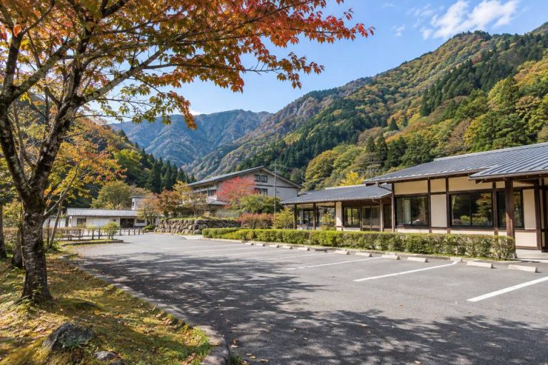
龍王峡駅近く、渓谷散策に使う市営の無料駐車場。公衆トイレは多目的設備があり24時間利用可能、冬季閉鎖なしです。駐車後は徒歩で虹見の滝やむささび橋へ。駅から虹見の滝約12分、むささび橋周回は約2km・1時間。今市ICから通常約35分です。
案内を読む↗県営湖畔第一駐車場|24時間・229台、朝4時区切りの500円と共通券
中禅寺湖畔、24時間入出庫可能な県営駐車場。229台、乗用車枠は長さ5m・幅1.9m・高さ2.1m・重量2tまで。普通車1回500円、バイク200円、バス2,000円で、朝4時に日付を区切ります。県営11か所の共通1日券は普通車1,000円。船の駅中禅寺へ徒歩約3分です。
案内を読む↗輪王寺第2駐車場|乗用車500~1,000円、季節で変わる受付終了時刻
日光山輪王寺の一般乗用車専用駐車場。料金は時期により500~1,000円、予約不可、二輪・三輪不可で車の大きさによる制限もあります。受付は4~10月7時30分~16時、11~3月15時まで。積雪や落葉で開始が遅れたり、行事で利用できない場合があり、寺院の拝観締切とは別です。
案内を読む↗